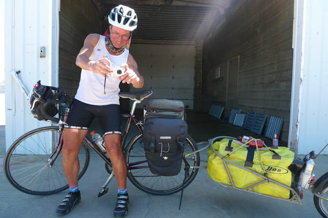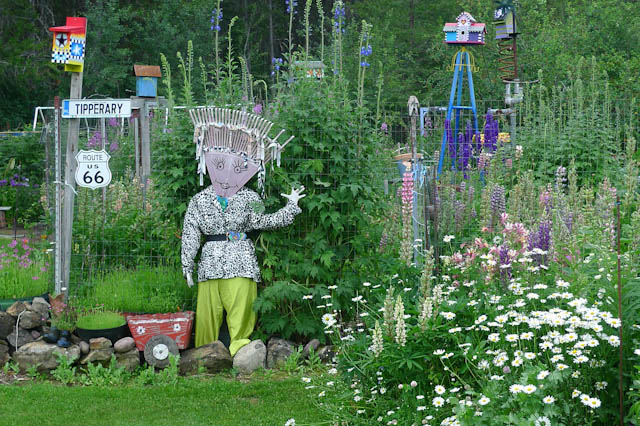
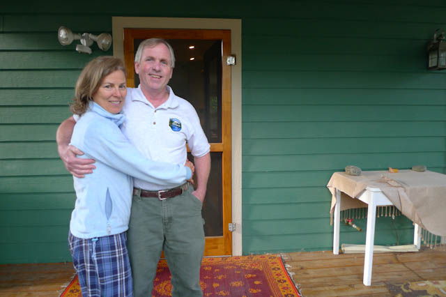
We were sitting with Rita in a cafe just outside of Glacier National Park. We had ridden out from Whitefish with our host Rita, now acting as tour guide. Second breakfast had not quite filled the void and we needed pie. “What type have you got?” The long list included Fruits of The Forest pie. “What’s in that?” He gave it quite some thought. “I know its got Rhubarb in it”. Now, I know it is unfair of me but I had to question his definitions of both ‘fruit’ and ‘forest’ as far as Rhubarb goes.

We sat quietly and waited for pie, all three of us reading our educational place mats. Mine was rather appropriate to the problems I had faced back in Whitefish. If you are going to do anything other than ride on a horse across the vast distances of this country you are going to have to pay attention to your choice of wheel. Mine had broken on the way into Whitefish on the appallingly surfaced Highway 93 and I now have a Surly hooped rear. The pioneers had similar issues.
Joel Palmer who led many wagon trains Westward, couldn’t emphasize the importance of wheel choice strongly enough “Wagon wheels” he suggested, “should be at least one and three quarters inches wide; three inches would be best of all for the crossing. The rims should be at a minimum, three quarters of an inch thick”. My new hand built Surly wheel certainly looked the business and I think Joel would have liked it.
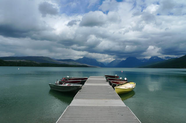

For the touring cyclist, the ride through Glacier National Park is made fiendishly complicated by time restrictions on certain sections of the road. We planned to wait at Apgar for the 4pm run time, and then bike up the side of Lake McDonald to the furthest campground and then get on the road early to make it to the top of the Logan Pass before the 11am ‘cut off’ time for riding.
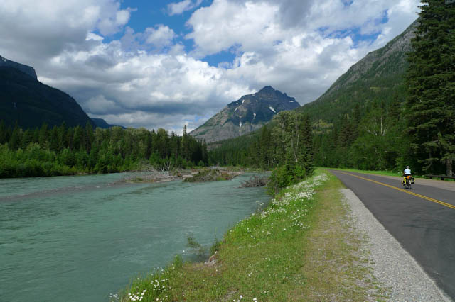
It is all a big inconvenience, and if the forty people we had spoken with back in Whitefish on the subject of The Road To The Sun, had not all said “the ride is one of the greatest you will ever do in your life”. Then we may have not bothered, just because of the inconvenience of it all. It had only been open a week after the winter snow, the second latest opening in history. We had to do it.
Glacier National Park is home to every single one of Americas native carnivores, with Grizzly Bears being the one you will be giving most thought to as you try to get some sleep. Almost every person we saw was carrying bear spray and we had our trusty orange coloured whistles. “Does that spray stuff work?”, I asked an old guy some days later. “Well do you know how to tell the difference between Black Bear shit and Grizzly shit?”, he was going to tell me that was for sure. “Well the Grizzly shit has got bells and whistles sticking out of it, and if you sniff it, it smells of pepper spray”.


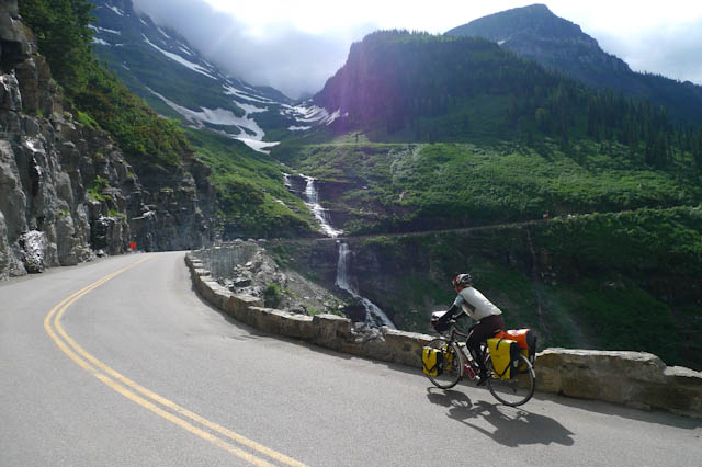
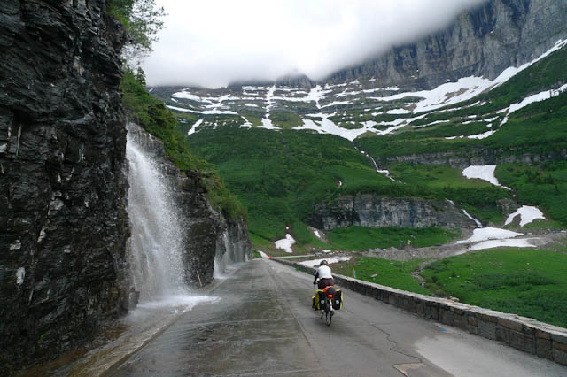
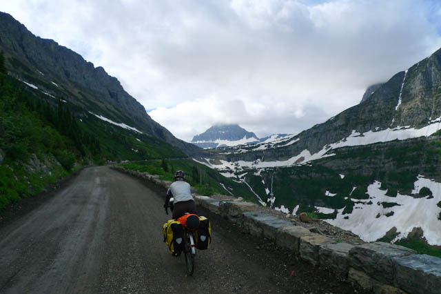
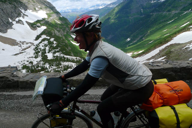
We were on the road early from our camp at Avalanche Creek with the cold forcing us into full winter clothing. It was perfect weather for the climb, and the sun would burn off the majority of the cloud as we climbed. This was so rare, this was perfect, this was what we deserved for all that riding into the headwinds of the West Coast. The Ride to the Sun on that morning was the most perfect, most beautiful climb I have ever done from the first turn of the wheel.

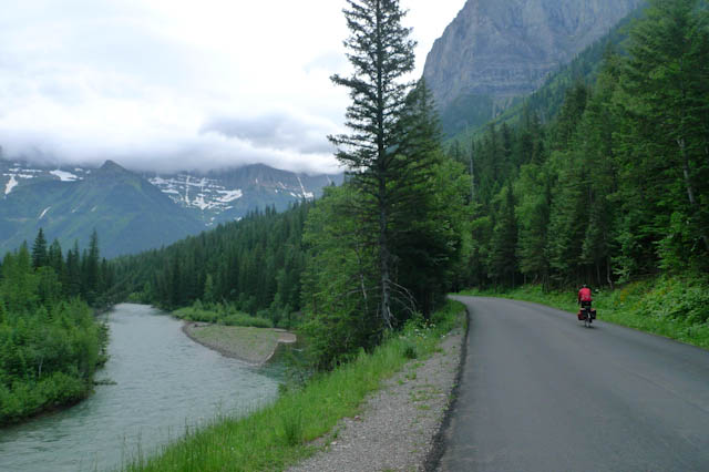
Up we went at a grade that never went much above a 5%. I could try to describe it, but a few photos would probably do a better job. Towards the top it turns to hard packed gravel that would be a nightmare in rain. At one of the stops for road rebuilding a red haired elderly lady pulled down the window of her car as we passed, “may the force be with you”, she shouted, which was not what I expected.
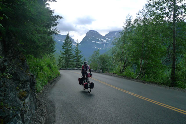

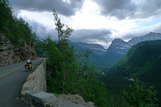


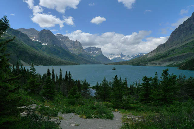
We pitched the tent that night at the Johnson’s Campground. We were still at 4,500 ft, which was a bit unexpected. The next morning we left the Northern Tier route at Saint Mary, and headed away from Canada on Highway 89 towards Browning.
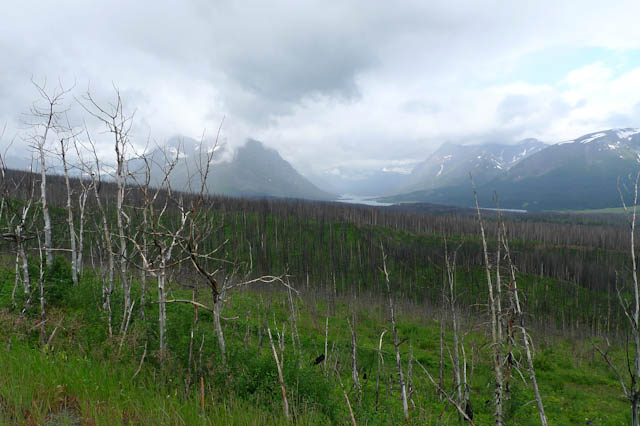

I think we expected to have an easy day as we rode down towards the Great Northern Plains. So a climb back up to 6,069 ft, just 35 ft short of where we had been at Logan Pass, was a last kick of the ball from the Rockies, and it went out with 7% grades, just because it could. This was a hard start to the day, even before it started to rain. We had been so lucky the day before.
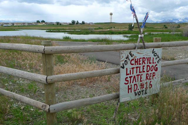
We needed that luck to stay with us as we were going through the Blackfoot Indian Reservation of Browning. Never has a town come more heralded as a place not to stay or even linger in. From over 200 miles away we started to be told of the danger and downright unfriendliness. From ten miles out the broken glass began and five miles out and we got chased by dogs who had picked us out from far down the road. The road was flat and a tail wind gave us enough speed to outrun them, but they had meant business.
As we got closer the road was covered with skid marks and signs marking the site of fatal crashes. Every run down steading we came to had us nervously scanning for danger. Magnificent wild horses ran along side our bikes and even more roamed the streets as we came into town. This was rough.
Up ahead two dogs chased out into the street barking at cars. The two people with them made no attempt to control them and we were riding into them. They looked big, but as we got closer, they shrank in size and the two people were young girls who started to wave and shout “Hello”. They were so lovely, just too young to control two big young dogs. We shouted back, our hearts broken.
At the main junction we were unsure of the turn. I pulled forward to draw level with a sheriff’s car to ask. Down came the window and before I could ask the Rayban Cop started “You can’t make a left turn, it’s illegal!”. “You have to take the crossing”. We were quite obviously going to get a ticket from this guy. ” Are you sure about that?”, I could not keep my mouth shut, “We have done 6,000 miles of left turns”. Did this guy want a bribe to take a left turn or something? Within 200 ft of where were standing there would be a thousand offences being committed, starting at bald tyres and working up to the serious stuff.

He meant it, and we got off and walked to the side of the junction. There were cop cars everywhere, some tribal and some sherif, others were poor attempts at unmarked vehicles. A very scary place we were glad to be through. Onto Highway 2 and we got the full advantage of the tailwind and straight road that will be our route for hundreds of miles ahead.


The railroad will stay with us as well and now grain silos are the tallest structures to a horizon many miles distant. We camped at Cut Bank and during a desert cold night heard Coyotes howl. This was the Northern Great Plains, and this was different indeed.


Next morning I was up early. The night had been completely still with not a breath of wind after about 5pm. The flames from the stove were being pushed the wrong way by a slight breeze. “NO, a bloody head wind”. A few minutes later and it was as if a fan had been turned on it was so abrupt, and so perfectly from the right direction.

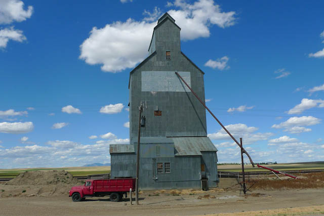
We rode Highway 2 like a rail. The wind pushing us on as we mashed the big chainring on our Dave Yates’ tourers towards the sun. We made quick miles to Chester and pitched on the town park. The grass is moist, green and tended by an unseen fleet of sprinklers. ‘Camp to the North of the park only, the sprinklers come on at 9am’ read a sign,’ have a good stay and stay dry’, it added. Power outages from storms had left the control system scrambled and we got doused at 8pm and after a guy fixed things, again the next morning at 6.30 am.

We were on our bikes for a repeat of the previous day down Highway 2. The monotony of it all I find so difficult. For entertainment we revert to our 8 year old selves and wave at things. Every motorbike is greeted and we shout with joy when the driver of one of the trains hoots back. A slow moving aircraft comes towards us and we wave. We are the only thing for miles and he dips his wings in reply. Forget infinite numbers of monkeys and typewriters and the works of the bard. If you want to have the any comprehension of the infinite, take a ride on a bicycle out here.

A few days of riding have taken us up amongst glaciers and now we are riding on the Great Northern Plains. At Sage Creek, a rare flowing river, the air is filled with the sounds of screaching Martins in flight and a Coot with three chicks calls in alarm. We pick up a business card at a remote bar, ‘ Four wheels moves the body, two wheels moves the spirit’. We end the day in a Motel in Havre and celebrate our first six months on the road.
