Cambridge, ID. and a meeting with a Timberwolf.

100F/41C in the shade, 116F/46.6C in the sun.

Let me just share with you the local weather forecast for the days ahead here in Cambridge Idaho – 97,100, 101, 97, and two cool days of 94, 94, and yesterday when we arrived here it was 101’f forecast as shade temperature To get some idea what this feels like to ride in you will need two hair dryers held out in front of you. Turn them both on full. You will notice that it becomes painful to blink as the moisture that lubes your eyes evaporates. ‘ How are you enjoying your holiday? ‘ Well, I am afraid that in this blog I moan about the heat. You will just have to bear with me.

Flag.
Flag.

The ride out of Missoula is along suburban tree lined streets. We have managed that rare trick of both getting up early and leaving early. We are retracing our route back to pick up HWY 93, gaining the height that we lost as we dived down into the town. We could very easily have taken another day off in the coffee bars and micro brew pubs. Another glass of 8.4% beer and we may have needed to. Half a dozen miles done and we take a right turn onto HWY 12 and line up the wind at our back and the climb somewhere ahead of us.

Remnants of the forrest fires, I.
Remnants of the forest fires, I.
Remnants of the forrest fires, II.
Remnants of the forest fires, II.

There are obvious signs of a recent fire. Trees still stand on the hillsides but they are matchstick black and bar code stark. There is rebuilding of homes burned out by the flames. It all looks so random,some untouched, so down to a turn of the wind. I guess it was late last year, but still the smell of burning hangs in the air.

On the climb to Lolo.

The climb is starting, we can feel that loading in our legs. It fails to register as a grade on the altimeter, but the figures on it and the gps are showing that we are gaining height. Beyond Lolo Hot Springs the road gets into its stride and pitches up to make towards the summit ahead. It is now 12.30 and 98’f. The wind we had at our backs is now nothing more than a breeze which is easily lost to the forest on either side of us. A sharp left and we are in slack air, held in a heated doldrums of pine resin smells. There is water near, and we can hear it tumbling over rocks on either side of the road.

Keeping a cool head.

Esther is ahead. Up the road after I have stopped to eat, take a photo or something. I come around a bend and there is a Coyote standing over roadkill in the middle of the road. It goes to pick it up, but I startle it and instead it looks up at me. I am still moving forward, closing the distance as I try to work the situation out. Our eyes meet and with about 12 feet between it and me it has a decision to make. It chooses to drop the kill and slowly make off into the trees on the opposite side of the road. It is amazing how quickly it vanishes. I have stopped the bike and try to pick out where the Coyote is. That was amazing. A car comes and this moment in time is broken. I am left wondering how big Coyotes are when you are close to them.

Entering Idaho and the Pacific Time Zone.

Lolo pass is the last time on the traverse that we will cross the Continental Divide. It amazes us that anyone can work this stuff out amongst the jumble of geography. This time we have the double excitement of both passing into a new state – Idaho and entering a new time zone. Until yesterday I had my watch on Kansas time as a way of getting to bed early and up prompt. Again I am an hour ahead. The road has the very good manners not to push beyond 5% grades. It is a beautiful climb, but the road surface now we are in Idaho is rubbish and demanding of our attention at all times. A sharp descent and we pick up speed. The nature of the forest is changing. A river to our right and now there are almost pure stands of Cedar Trees, some of great age. This is stunning biking.

...99 miles.
…99 miles.
Down from Lolo Pass.
Lolo Pass Info.
Lolo Pass Info.
Lochsa River, Idaho.

HWY 12 started the day like most other roads and has now become near perfect. We have the benefit of a few generations of civil engineering pushing a road through and over the pass here. When Lewis & Clark came through there was no way through other than high level game tracks and trading routes. The trees crowd the road again giving us shade. Here they are old Cedars hung with moss and lichen, trunks the colour and texture of Michael Douglas. We park the bikes and walk amongst them.

Big Cedar Trees.
Big Cedar Trees.
Cedar Trees and shade.

That was as close to a perfect day on a touring bike as you are going to get. Powell, and the free camping spot offered by Lochsa Lodge. A bit of bike maintenance on the gears and drive and then the undeniable joy of good food cooked well and a beer. You pay a bit of a ‘ stuff needs to be bought here from miles away ‘ premium, but heck we are worth a bit of pampering after a hard day. We relax and chat with the staff – ” And what is that stuffed creature ” . I am asking because it looks identical to the beast that I met in the road – ” That sir, is a local timberwolf “. I am amazed, shocked and more than a bit chuffed. It was big for a Coyote, but I had thought too small for a wolf – not so.

Warren sorting the gears.
It looked just like that...
It looked just like that…

We awake to a morning that is surprisingly cool so far. It is 5.30 and we are up and away not long after 6.30 to a morning that promises almost 90 miles of unbroken downhill – hurrah!! There is a blue newness to the light and a distinct nip in the air held in long shadows. You really must find a way to visit HWY12 on a bike, it is now in our top 5 ‘ roads we have been on list ‘. There are few times that you can watch a river grow, to change its nature, to mature from high mountain youth. Here you get to watch things happen as you ride. By Lowell the Lochsa River is broad, but still fast flowing. For the first time in over 1,000 miles we are under 2,000 ft and have done 67 miles all before 11.00 am, so not a bad morning.

Lochsa River, I.
Lochsa River, I.


Lochsa River, II.
Lochsa River, II.
Lochsa River, III.
Lochsa River, III.
Tree.
Tree and beard lichen.
Esther resting.
Esther resting.
Lochsa River IV, the far end of the valley.

A few miles further, the Lochsa is as broad as an interstate. It is joined by the Selway and all of a sudden the landscape changes. The trees are gone, a line has been crossed and there are now bare sun bleached mountains around us. We are in a deep canyon cut by the river. The heat drops into the slit in the ground and is held there for us to ride through it. This is a whole different environment and very much less comfortable. We are in high desert and not liking it much.

The Truth.
The Truth.


Cooling.
Cooling.

At Kooksia we turn left onto HWY 13 and soon the day ends with 92 miles done with just 481 ft of climbing picked up somewhere without noticing it. We camp behind the grocery store in the little town of Stites, which is a better spot than it sounds from that description. Jim comes by to cut the grass ‘ There is a church breakfast here in the morning ‘. He apologizes for the noise and disturbance and settles down to drink a tea with us. We always wonder why people move to these odd little towns. ‘ Well I was in California and wanted to get away from the 100,000 mile a year driving and work stress ‘. His computer cursor stopped at Stites ‘ I watched the doppler forecast and stalked this town online – ‘ knew more about it than the people who live here ‘. Jim worked out that he liked it enough to move here, ‘ Of course when I got here I found that the town is in such a deep canyon that the doppler doesn’t work ‘. Still he picked up a job and settled down as the man to go to if you need things done. Like many he still has stuff spread across lockups in 4 states, but shallow roots are here. We talked till too late, but that is fine.

Climbing "the wall" just behind Stites, ID.
Climbing “the wall” just behind Stites, ID.
Hay bales.
Hay bales.
It is a different world to the valley.
Corn fields on the Grangeville plateau, Idaho.
Jim, from Stites, ID.

Next morning, a brutal climb up and out of the canyon. It is climbing at 8 or 9%, but then goes up and we are off, pushing with enough effort to make our backs hurt, it is 13%. We gain the top and unexpectedly, this is where the farming is done here. Flat fields and high yielding corn and hay crops – amazing. Every tractor and bailer that is not rusting in a yard is out in the fields working. We follow a ridge road until the descent into Grangeville breaks the morning ride. Jim pops along to say goodbye on his custom bike – you just knew he would have one didn’t you. The best place for breakfast is Hilltop Diner – which you guessed correctly, would be up a stiff climb in the wrong direction.

The profile.
The profile.


White Bird Summit on Old 95.
Dropping from Summit to White Bird town, Idaho on Old 95.

The second climb of the day regains almost all of the height that we lost yesterday. But it does it in a brutally short distance. The heat is building as we near White Bird summit and we pull over to take a long drink in the shade of the last trees before the descent. 3,400 ft and the climb has gone well. Not for the first time, we are so glad we are going in this direction. We are about to dive into hell. Sharp left and right turns which today are done on tarmac that is boiling and bubbling, popping as our tyres ride over it.  A sharp left and we get a glimpse of the new highway as it cuts across the landscape. Our old road takes in the slopes, you get to feel the contours. This is a classic climb, good enough to bring bikers from hundreds of miles away, it is Alpine, but in an oven. Keep it smooth don’t let the melting black-top grab your wheel. 111’f and we are down in the town of White Bird. Miraculously, there is a bar and it is open ” Hot out there? ” We all know the answer.

Decent on Old 95., II, 111F/43C.
Descent on Old 95., II, 111F/43C.

42 miles, but that is it for the day. We expected to do more, but we are not idiots. We sit is the shade and wait for the sun to drop behind the mountains before we put up the tent. At 6.30 pm it dips bellow the rim and the town is in shadow. Time for the bar flies and dogs to come out on this Saturday night. We get a good nights sleep and are cooking oats before full dawn and are pedaling not long after 6.00 am.

Salmon River Canyon, I, Idaho.

The old HWY 95 joins up with the new road to squeeze through canyons ahead. Idaho is famous for potatoes, this I knew. I did not know how much of our road would be through desert because I had not bothered to look it up. Over millions of years the Salmon River has cut into the volcanic rock here as it has risen slowly. The combination of erosion and lift has resulted in deep canyons and now, a tourist industry based on going down the river in more or less safe ways. The heat of the day overtakes our ambition. When a cabin comes up with air-con, we bail out after 43 miles. This is just too hot.

Salmon River Canyon, II, Idaho.
... be warned....
… be warned….
Our cabin at Pinehurst Resort.

The next morning there is spits of rain and the sound of thunder far off ahead of us. The forest we have climbed into at the end of yesterday is cool. There on the screen of the Mac the WWW, says that Cambridge is already clear and the forecast for the day is 101’f. This is almost too impossible to comprehend, the contrast too much. It is like trying to pack for a holiday in Australia in a Scottish winter. We are late to get up too, but is just 52’f as we start out.

Small Salmon River.
Small Salmon River.

The climb is gentle enough, but then a sign points to a ‘ Chain Up! ‘ pull over and the climb begins in earnest. My legs do not want to turn up for work today. My gear system is now 33,000 miles old and is dropping the shifts that I need. This causes ‘ Potty Mouthed Outbursts ‘ of great passion. I simply can not find the right gear in time not to throw away all forward speed. Fury does not even come close to describing it.

The 45th Latitude.
The 45th Latitude.

The road slackens and we drop into wide meadow land with contented black cattle that watch our passing with the usual bovine curiosity. The 45th parallel comes up – we must have passed this many times without note. By 10.00 am the last of the morning clouds have gone. We are in New Meadows, a town on a junction of three roads. It has 1 gas station, 1 post office, 2 stores to buy stuff in and 6 places to eat. We eat in one of them and take the right turn option. We are going to drop into Canyon Country once again. And this is where things go from bad to worse.

HEAT.
HEAT.

Out of the tree cover and it is 106’f on my meter. This, we learned back in New Meadows is classified as desert. It is easy to see how and the meter goes up to 112’f as the vista opens to scorched grass and high fire risk warnings. Our journey’s record of 116’f is equalled and the there is a hill. I have to walk so as not to build up body heat with the effort. The soles of my shoes burn into my feet as I plant them on the scorching tarmac. We get to Cambridge by force of will. We are hosted by Bob and Leslie in an oasis of air-con and good food. Ahead in one or two days our route passes through Hells Canyon on our way into Oregon. It is not going to get much cooler We will have to get up earlier or fry. Sorry for going on about the heat – but you just had to be there.

Don't overheat on the hills.
Don’t overheat on the hills.
White Bird, sketch.
White Bird, sketch.

Missoula, and a visit to Adventure Cycling HQ.

Esther at the Adventure Cycling Association, Missoula, MT.

There are pictures on the WWW. of people not too much further ahead of us than 100 miles, going through this area in coats. In a few short days Montana, the Big Sky Country AKA – ‘ The Last best place ‘, has turned to dog biscuit dry and oven range hot too. We are in a diner just a little on from Sheridan. Getting up early and putting a few miles on the clock before first breakfast, we have tried to beat the heat. There are two big climbs today that will coincide with the full heat of the day no matter what we do short of biking at night.

Montana barn.
Montana barn.
Some river Lewis & Clark crossed, Montana.

I am the only guy not wearing a cowboy hat or a baseball cap. Seated too far from the table of farmers I can only hear the occasional snatch of conversation. The punchline to the last story was – ” And you know what, we never did find that snake “. On we go and already it is hot enough to be a heat-wave in Scotland. Hay crops are drying, some being turned and a few ready for bailing. This is grass country and not a good place to live if you have any sort of pollen allergy or dislike of cows.

Warren makes a note.
Warren makes a note Beaverhead Rocks.

     Dillon is ahead and the first of the climbs. For the first time on this side of the country we are biking in the footsteps of Lewis and Clark. The road uses one of the natural gaps in the landscape. Beaverhead valley is named after an outcrop which with a huge amount of imagination, resembles a Beaver. This is the gateway to ancient hunting grounds and is now a nature reserve. Cranes call from the pools under Beaverhead Rocks. Time in this landscape feels like it passes at the very opposite speed to ‘ Dog Years ‘. Lewis and Clark would recognise just about everything and like me would conclude that modern music is rubbish.

Prairie.
Prairie.

   45 miles to Jackson, with no bailout and it is 102’f to begin the days climbing. I think we have got the measure of the road ahead, but we will underestimate the wind, which is twice as strong as advertised. Parchment dry, the air has to be gulped in with the effort of the climb. Within a few minutes my mouth is uncomfortably dry and my front teeth are glued to the inside of my lip.

First climb.
First climb.

    6,000 ft showing on the gps, so just 700 to do. I am concentrating on a patch of road just half a dozen feet in front of my wheel, tying not to look up at the climb ahead. Legs need to stay fluid, turning with power on the down, but also pulling up through the cleats locked into the bike. Trying to stay loose enough not to grip the bar too much and tense up, but not flapping around and allowing the bike to flap from side to side. I must not give any energy away, nothing must be wasted on a climb. Other bikers have shoes and stuff dangling from their bags. On a climb you have to fight against these as they flap, they drain your power by 1% of 1%, but it adds up.

Post box, Montana.
Mail box, Montana.
Tom, the last of the "racers".
Tom, the last of the “racers”.
Filtering water.
Filtering water.
A down from the second pass.
Big fields for cattle, Big Hole Valley, Montanan.
Big fields for cattle, Big Hole Valley, Montana.

Big Hole Pass 7,400 ft and not a moment of it can I remember now. A purple line on the gps stretches to Jackson. It is not far at all, but always beyond one more curve, one more shoulder of the hill. I have never worked harder to get to anywhere and yet not one of Jackson’s population of 38 is on the streets applauding our arrival. We camp behind the Hot Springs Hotel. 86.62 miles and 3931 ft of climbing will take more than half an hour in a thermal pool to recover from.

The last rise before Jackson, MT.
Big Hole Valley, Montana.
Welcome to Jackson, MT

I am trying to get cold water to come from the taps in the place, not knowing that this is impossible. A still night but warm enough for mosquitos to make gazing at the stars uncomfortable. Cows do their calling and later in the night Coyote cry out to each other.

Barn.
Barn.
Trophy in the bar, Jackson, MT.

The land of 10,000 Haystacks. Big Hole Valley grows cows and grass in inconceivable quantities. The worlds biggest hay bale was made here, which had a sort of inevitability about it. Grass fields, if you can still call them fields, stretch to a horizon of snow-capped mountains that rise abruptly. It is like Switzerland on steroids.

House in Jackson, MT.
Big Hole Valley.
Big Hole Valley.
Road 278 between Jackson and Wisdom, MT.
House in Wisdom, MT.

Today’s climb starts to pull upwards at Beaver National Forest. The big sky of the plains is broken for the first time in many miles by trees. Yesterday’s climb was dry and here we are with the sounds of running water. We had to stop and filter water yesterday, and searched for miles to find a suitable stream. Today, mountain fresh water is tumbling all around us. This must be one of our favorite National Forests. Pine resin heated by the strength of todays sun is filling our lungs. You can bike through a million miles of pine in northern Europe and never get this intensity of smells. Off to the side there are deer sheltering in shade, they watch us pass.

Standing water around Wisdom, MT.
Gentle climb to the pass.

7241 ft and another crossing of the Continental Divide for us. I have nothing what so ever left in my legs. So hurrah for the longest downhill of the whole coast to coast adventure and thank goodness for glaciation or we would have to climb thousands of feet more. A right turn onto HWY 93 and we dive down in the direction of Missoula 3,000 ft bellow us.

Beargrass
Beargrass
Bitterroot valley, MT.
Chief Joseph Pass, MT.
... downhill.
… downhill.

It was hot at the top and descending we drop into air that is hot to the touch. It roars in our ears as we get up to 40 mph. We drop into Bitterroot Valley and into the town of Darby for the nights campground. It is one of those nights in a tent when an unplanned movement will bring cramps and swearing in equal measure. Now the nights may be clear, but we have lost the cool of altitude.

Warren got a hair cut.

  A tailwind and we still have more delicious down hill to ride. The Bitterroot River joins us as we pick up a bike path. This keeps the feel of a mountain river as it and Team Sportswool enter a much more populated part of Montana for a while and the relative flesh-pot and hippy town that is Missoula. Our ride is by the side of a busy highway now, but still the scenery is breathtaking. If you want to spend retirement with a fishing rod in your hand, you could do far worse than move here.

Crossing the Clark Fork River, Missoula, MT.

  Once more, and now for three days in a row, the day is longer than expected. We want to call in on Adventure Cycling HQ. Inevitably, it is at the far end of town. The team greet us like family, which I guess we are in a strange way. We get our photos taken for the national archive and our bikes weighed. This was a number I am not sure I ever wanted to know, but here it is. Let the records show that Esther’s bike weighs 87 pounds and my bike weighs 89 pounds. We have to pedal all of that weight back up the hill will just came down when we start again. Esther has a new sketchbook for your delight – it can be seen HERE!!!

Jackson Lake and Great Tetons. Sketch. Esther

A hard way to get to the 4th of July. 30,000 miles done.

Rodeo 3rd July, Ennis, Montana.

You really should not judge a wine by its label. We do of course, and buy anything that features a bicycle even if it tastes like chain lube. Books by their cover, well of course, and beer too. Bike shops by what is in the window? Well it took me almost two years to eventually use the best bike shop back home in Edinburgh. It’s window features pink bells and kids bikes that weigh as much as a small car. You may not notice the jockey sized guys that treat the place like a second home or community drop-in centre. There are the framed team shirts ” Thanks for all your help Chris “. But there are no top end bikes at prices that would put your daughter through college. You are in the right place for the simple reason that Chris is an engineer who worked on nuclear subs before he bought the shop. Chris will fit a new tyre and line up the trade name with the valve -” So you can find it in a hurry “. You will never go anywhere else without feeling dirty at the betrayal. This is your shop now.

Mural in Lander and Warren, Lander, WY.
Bike shop, Lander, WY.

We had been riding in the gutter for miles. Forced over by RV’s and gauping holiday traffic, in fear of our lives. If we had waved farewell as we left Baltimore with a cry ” See you in Yellowstone 4th of July “, we could not have coordinated our arrival in Americas prime holiday destination any more perfectly. Which is how we find ourselves standing outside what may be a bike shop in the town of West Yellowstone. We have just biked through the park on the second busiest day of the year. Esther has a rear tyre that has picked up a slash and puncture from a slice of metal. We have super-glued the cut back together just in time to pick up a flat from a shard of glass. We need a rather specialised German-made, awkward sized replacement and all we can see are aeroplane model kits and kites, and of course horribly pink children’s bikes.

Les from the Bike shop in West Yellowstone, MO.
Les from the Bike shop in West Yellowstone, MT.

” Do you have any touring tyres? “. ” Do you have Schwalbe in 700X32 in the Marathon? ”  The fact that the answer to all of these was ‘ YES ‘ is more random than you could possibly imagine. Les has been running a bike shop here for 40 years. He built some of the first mountain bikes, and oddball stuff like three person machines on jigs that he put together himself. He shows us the ‘ archive ‘. ” Did you ever serve anyone famous ? ” I’m not sure anyone ever asked Les this before. ” Well I did serve Greg Lemond’s wife when she rented a video here “. Les had a stock of 4,000 titles that eased the cash flow when the snow lay as deep as the ears on a four year old child. We are in the right place.

A big sky, Wyoming.
A big sky, Wyoming.

A two day rest is not mathematically twice as good as a one day, but it is not too far short of that. Lander had been good to us but we are starting to get end date anxiety and need to put some miles in. The fluffiest of fluffy clouds drifted across the bluest of summer blue skys. It was the perfect day to be biking along HWY 287 into the Wind River Indian reservation. We are back amongst the Sage Bushes and infinite horizons. A sharp left and we pick up a headwind.

Down into the Wind River Valley, WY.


Down into the Wind River Valley, WY.
Wind, as in Wind River, WY.

There is of course a clue in the fact that we are now running along the Wind River Valley. Like idiots, we had mentally labeled this ‘ an easy day ‘. Crowheart stores after 13 miles of unrelenting toil into what is now a gale. We contemplate a further 30 miles of this with the sort of stoicism that a store Santa must show on being handed a child that is already screaming and will no doubt urinate within moments. We make easy conversation with people at the store and then turn out onto the road as it runs under the shadow of Windy Mountain.

Rescue in form of a wonderful gentlemen with his pickup truck.

7 mph and the occasional 11 mph and the horrid mental arithmetic that we are going to be doing this for the next 5 hours, minimum. This is the worst of tortures on a heavy touring bike, the pedalling down hill in the Granny Gear. 10 miles creep by, and now the wind is dangerous. We are being lifted off the road. The casual conversation back at the store brings rescue. ” I couldn’t let you go on “. A big, very big black truck has swung off the road in front of us. The bikes are lifted into the back and we are safe. You would need a heart of stone to call it cheating and yes we are happy to be away from the roar of the wind.

Out of Dubois, up the hill. WY.


Part of the Teton Wilderness mountains in the distance.

We get a glimpse of farming in one of the windiest places in the USA. ” You can cut your hay crop and the wind will pick it up and you have to bale it on your neighbours land “. A lift into Dubois and we pitch at the campground in the shelter of a building. A cold night with the belt of the Milky Way arching across the deep black sky. Team Sportswool are up early the next morning to try and get miles in before the wind hits. There is a big climb to bring us up into the first of the National Parks – The Grand Tetons. Up we go through Shoshone National Forest, already over 8,000 ft. Beyond 9,000 ft, there is snow under the trees at the side of the road. This is a pure climb and the effort equals reward, not the nasty toil of biking into wind. This is riding ‘ in the moment ‘ and lifts the soul. You could call it ‘ floss for the mind ‘ and is why cyclists go looking for climbs and turn from headwinds. At 9,584 ft we enter the Tetons at Togwotee Pass.

Bear (grizzly) tracks.


Bear awareness.
Bear awareness.
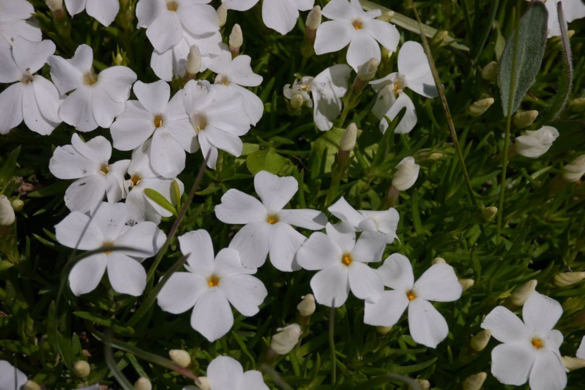
Alpine flowers.
Alpine flowers.
Impressive Ridge (part of Tetons wilderness), WY.
Impressive Ridge (part of Tetons Wilderness), WY.
Stretching legs.
Stretching legs.
Togwotee Pass, 9658 ft.

With less than 100 ft biked beyond the celebrations of passing through our 30,000th mile Esther has the puncture that will lead to the visit to Les. Down we go, the tyre held together with glue and some of the joy of reaching 30,000 miles rubbed off. Oxbow bend and then we take a right towards Signal Mountain and our campground for the night. Places are full, but bikers get a sort of celebrity treatment in National Parks and a site is found.

... and down...
… and down…


The Grand Teton National Park in sight.
(swear words) & puncture.
Snake River, Grand Teton National Park, WY.
Hiker Biker spot, Signal Mountains Campsite, Teton NP, WY.

Another crisp chill night. We are fatigued by the climb and the battle with the wind and sleep for over 10 hours after 63 miles and 3264 ft of climbing. Next morning there is almost unbroken sharply blue sky for our ride into Yellowstone. We will be sharing the narrow park roads with what feels like 90% of the US RV fleet on what is the first holiday of the summer. Snake River, one of the longest in the country, joins us as we enter the park. There is now no shoulder and the road itself has a crumbling edge forcing us out. There is 23 miles of this to start your Yellowstone experience.

Esther sketching.
Esther sketching.
Grand Tetons, view from the  Northern Edge of Jackson Lake, WY.
Grand Tetons, view from the Northern Edge of Jackson Lake, WY.
Entering Yellowstone NP, WY.
A very different landscape.
Big Canyon, I, Yellowstone NP, WY.
Big Canyon, II, Yellowstone NP, WY.
Lewis River, Yellowstone NP, WY.

Crawfish Creek and Lewis Mountain come up as we bike beyond the 7,700 ft. This RV roulette is hard on the nerves. Will they remember they are towing something? are they even looking forward? We are high again, breathing the same air as the Angels and taking in some of the most stunning scenery the world has on offer. Again we end the day on a Hiker-Biker spot, the campground at Grant Village has been open for just 5 days since the Grizzlies left to feed higher up the mountains. It is just over 8,000 ft and we have our first night with frost on the fly sheet. It is a perfect spot. We sleep as the bears do bear stuff and the earth spins around to meet a new morning for us.

Isa Lake, Continental Divide, Yellowstone NP, WY.
Old Faildful, geyser, calm, Yellowstone NP, WY.
Old Faithful, geyser, calm, Yellowstone NP, WY.

The ride to Old Faithful begins with a hard pull up a short but brutally steep climb. We have tired legs that are feeling every one of the 30,000 miles and we are struggling to recover much overnight. Lake Isa and the continental divide at 8391 ft. Rain falling into this small lake has a decision to make. It drains both to East and West. To flow to the Pacific or take the long run to the Atlantic? The scale of Yellowstone becomes obvious as we ride. It is bigger than countries, certainly Malta, the island that we were on before here, and bigger than Lichtenstein from year 2 and Vatican City from last year. We are again biking in the gutter as the traffic builds and have a new danger to keep an eye open for – Bison Poo. Hit this stuff and you are off. We get a good view of Old Faithful. The photo above is of the coughing and spluttering just before the geyser performance. It was followed by a beep, beep and beep as my camera shut down having run the battery flat!

Hot Pool, Yellowstone NP, WY.


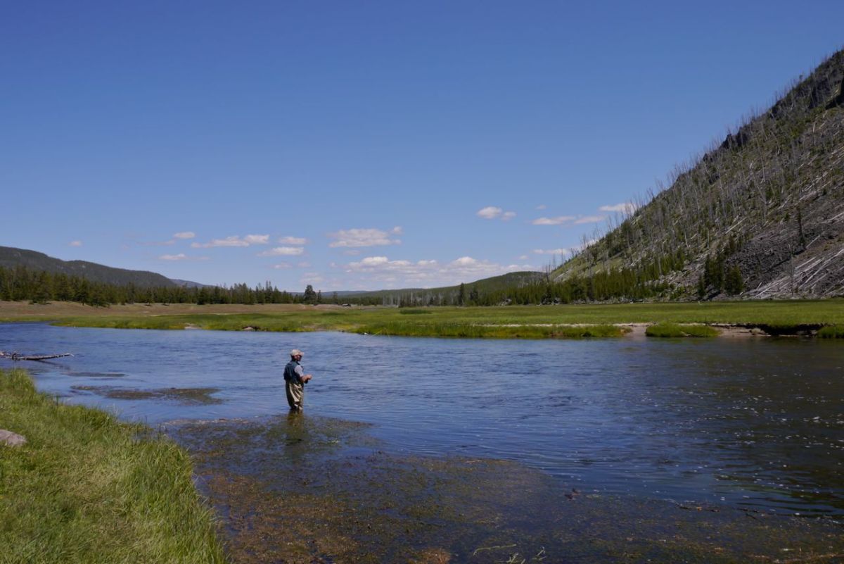
Angler, Yellowstone NP, WY.
Angler Madison River, Yellowstone NP, WY.

Down we go, heading for the park boundary and the border with Montana. A left turn at Madison and we ride by the side of the Madison River on its lazy descent to the park border. There are enough rods in the water to guarantee that most fish should be caught 2 or 3 times as they make the ground. It is a bit Disney, a bit perfect and the weather is glorious, but there are many worse places to be on a touring bike. We enter Montana, making it the first state that we visit for the second time on our journey. West Yellowstone, and a visit to the bike shop comes next.

Dairy Queen, West Yellowstone, MO.
Dairy Queen, West Yellowstone, MT.


Moma bear and cub, Yellowstone NP.
Momma Grizzly bear and cub, Yellowstone NP.


The big water fall, Yellowstone NP.
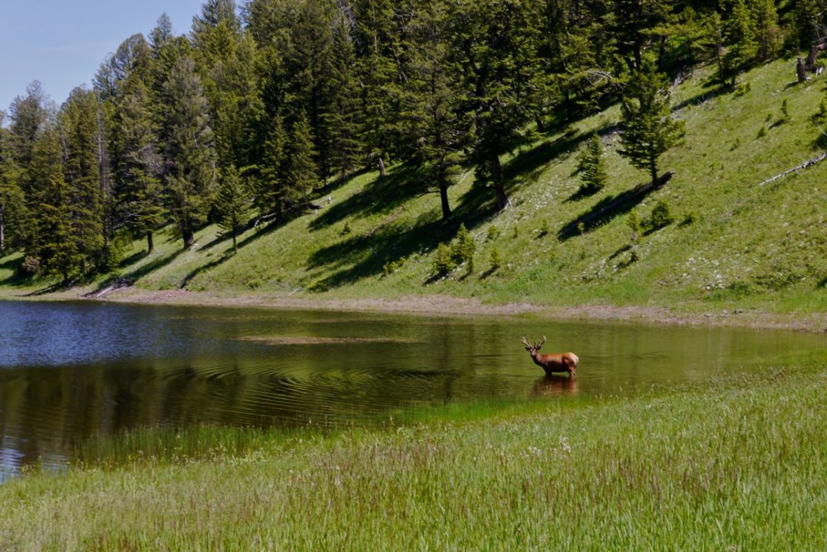
Elk, Yellowstone NP.

We book in at a campground. There is a photo of Evil Knievel, ‘ To my friend Mike, thanks so much….. ‘ You have to ask, so we do. ” Is that real? “, and of course it was, and so is the photo of the Knievel RV parked out the back. ” Was he doing shows here?”. Well no he was vacationing, just like the millions of other folk. We have a day off the bikes and tour the park in an organised tour in the comfort of a big yellow bus with aircon and suggest that you do the same if you do not have a death wish.

Hedgen Lake, Montana.


Beaver lake - with little beaver dam.
Beaver lake – with little beaver dam.
Earthquake Lake, Montana.

Back in the saddle we try to put some distance between us and the 4th of July celebrations. Out we go, along Hebgen Lake and today the tarmac is holding onto our tyres. A Osprey turns on the currants above us. Wonderful as it is I am finding motivation elusive today. Thoughts of ‘ just another 1,000 miles ‘ are dangerous but inevitable when you have biked so far. On August 17th 1959 this valley was changed for all time. A massive earthquake struck in the night. 28 were killed and in the next 3 weeks a new lake formed in a landscape tilted by the force of the quake. Trees are still there, now standing in the flooded bottom of the new lake.

Road parallel to Madison River, road 287, Montana.


... and rumble strips
… and rumble strips

A glorious and well deserved downhill with wind assistance. ” You have too much wind from the back, it’s dangerous “, a cry from a cyclist going the other way as we flash by. The sky has become big again. There are far off mountains rimming this wide cauldron and unbelievably they are still snow-capped. I take a drink from a water bottle. For the first time in ages it is hot water, 95’f and we are back ridding in an oven. My mouth is too dry to whistle and the air is crusting up my nose.  The town of Ennis is the goal for the day. We get there in good time, but would have needed to book a room a month ago. A patch of grass behind Willies Distillery is the traditional pitch for cyclists from day one back in 76. It is July 3 and the festivities have begun. Esther goes to a Rodeo, which is great fun and the next morning we take in the parade.

Happy Birthday America.
4th July parade, Ennis, Montana.

You just can not miss a small town parade on the 4th of July. There are people to meet, things to see, but there is always a horrid 2,000 ft climb in temperatures that never dip under 93’f just waiting for your attention. We hit it at the wrong time. 5 near misses and 2 very very near leave me swearing and cursing the driving ability of the nation. I look up on the WWW. and sure enough it is the most dangerous day of the year to be on the roads. We ride out all day along Ruby Valley. A stop at a store and a conversation with an old time local. Never underestimate old timers. ” If you want to get away on a day like this you have to get up above the heat. I built my own planes and we go high into the cool air and take my hat off. It was wonderful, truly wonderful “. The snow-covered peaks are now hidden behind the leading edge of an advancing storm. We take a room in a hotel in the town of Sheridan, and go to bed early after a good meal. Happy Birthday USA.

Everyone is dressed up, Rodeo in Ennis, Montana.